- Courses
- GS Full Course 1 Year
- GS Full Course 2 Year
- GS Full Course 3 Year
- GS Full Course Till Selection
- Online Program
- GS Recorded Course
- NCERT (Recorded 500+ Hours)
- Polity Recorded Course
- Geography Recorded Course
- Economy Recorded Course
- AMAC Recorded Course
- Modern India, Post Independence & World History
- Environment Recoded Course
- Governance Recoded Course
- Science & Tech. Recoded Course
- International Relations and Internal Security Recorded Course
- Disaster Management Module Course
- Ethics Recoded Course
- Essay Recoded Course
- Current Affairs Recoded Course
- CSAT
- 5 LAYERED ARJUNA Mentorship
- Public Administration Optional
- ABOUT US
- OUR TOPPERS
- TEST SERIES
- FREE STUDY MATERIAL
- VIDEOS
- CONTACT US
PLACES IN NEWS 4th JANUARY 2025
PLACES IN NEWS 4th JANUARY 2025

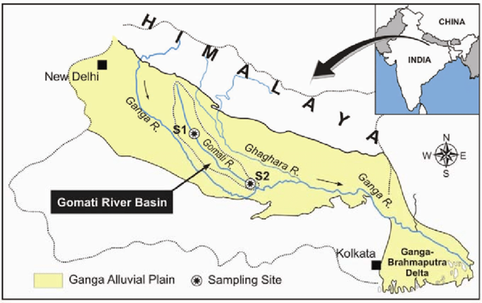
Gomti river
Why in news?
- The Territorial Army (TA) has raised a new unit dedicated to the rejuvenation of the Gomti River, underscoring its commitment to environmental conservation.
- This initiative aims to address the critical pollution and degradation issues affecting the river, a vital lifeline for millions in Uttar Pradesh.
About Gomti River:
- Origin and Geography:
- The Gomti River, a tributary of the Ganges, originates near Madhav Tanda village in Pilibhit district, Uttar Pradesh.
- According to Hindu belief, Gomti is the daughter of Rishi Vashishtha, and bathing in its waters during Ekadashi is believed to wash away sins.
- Initially a narrow stream, it gains volume as it flows through Lakhimpur Kheri, Sitapur, and Lucknow, where tributaries like the Sai and Kathina join.
- The river spans approximately 940 kilometres and meanders through 20 towns, including Jaunpur and Sultanpur, before meeting the Ganges.
- Path and Usage: Flowing through agricultural and urban regions, the Gomti provides water for drinking, irrigation, and industrial purposes. In Lucknow, it supplies water to the city while receiving untreated sewage from 25 major drains, highlighting the severe strain on its ecosystem.
- Cultural and Religious Significance: The Gomti holds a revered place in Hindu traditions. The Bhagavata Purana lists it as one of the five transcendental rivers of India. The rare "Gomti Chakra," found in its waters, is considered spiritually significant.
- Pollution Issues:
- The river faces critical pollution levels due to untreated sewage, industrial waste, and effluents from sugar factories and distilleries.
- These pollutants have severely degraded water quality and endangered aquatic life.
- Despite initiatives like the 345-million-litre capacity sewage treatment plant in Lucknow, inefficiencies limit its impact. Beyond the plant, untreated waste continues to flow into the river.
- Floodplain and Development Stress:
- High embankments, constructed after a 1970s flood, have disrupted the Gomti's natural floodplain.
- Urban expansion in areas like Gomti Nagar and Triveni Nagar has encroached on fertile land, further stressing the river.
- The Gomti receded significantly during the late 20th century, exacerbating ecological challenges.
- Riverfront Controversies: Projects such as the Gomti Riverfront Development, modelled after Ahmedabad's Sabarmati Riverfront, have sparked debates. Critics argue these projects disrupt natural river dynamics, increasing velocity, shear stress, and flood risks. Environmentalists emphasise that such interventions harm rivers, setting problematic precedents for other waterways in India.
- Health and Flooding Risks: During monsoons, the river rises 10–12 meters, causing floods that leave behind potholes and pits—breeding grounds for disease-causing mosquitoes. These health risks intensify the challenges of river management.
You Can Read Also: PLACES IN NEWS 3rd JANUARY 2025
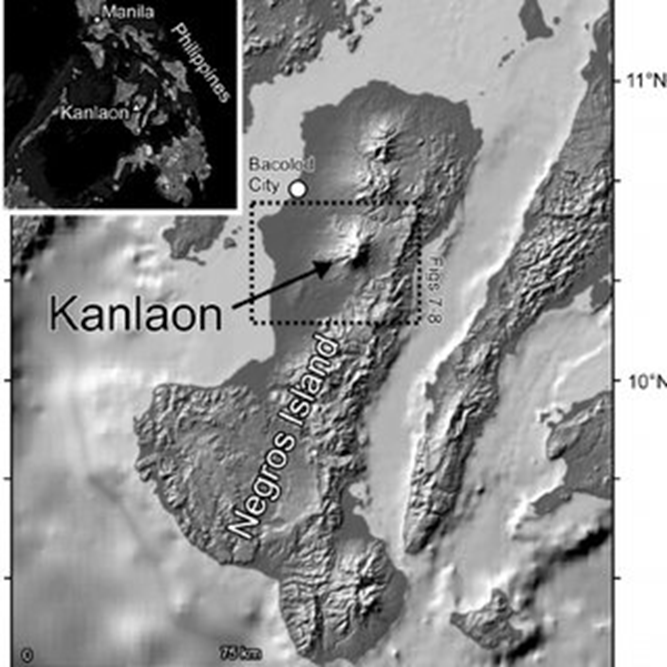
Mount kanlaon
Why in news?
- Mount Kanlaon, a stratovolcano in the central Philippines, has erupted, releasing a massive ash column into the sky and alarming nearby residents.
- The unexpected eruption prompted the government to issue immediate safety measures, including evacuation orders for communities within the danger zone.
About Mount kanlaon:
- Geography:
- Mount Kanlaon, an active stratovolcano, is the highest peak in the Visayas region of the Philippines at 2,465 m (8,087 ft).
- It spans the provinces of Negros Occidental and Negros Oriental, with a base diameter of 30 km (19 mi).
- Its active Lugud Crater and Margaja Valley, a caldera, add to its geological significance.
- Recent Volcanic Activity:
- The eruption of Mount Kanlaon sent a towering ash column into the sky and prompted the evacuation of thousands from nearby towns.
- Mount Kanlaon's eruptions are typically phreatic, caused by the interaction of groundwater with hot magma, resulting in explosive steam and ash ejections. Its location in the Pacific Ring of Fire makes it prone to tectonic and volcanic activity.
- Past Volcanic Eruption: The volcano has erupted over 40 times since 1866, with significant eruptions in 1902, which was Strombolian in nature (involved explosive bursts of lava and gas), and 1996, when three hikers lost their lives to sudden ash ejections. Eruptions are usually small to moderate, producing ash falls in surrounding areas.
Other Disastrous Volcanic Activity Worldwide:
- Mount Tambora (1815, Indonesia): The largest recorded eruption, causing the "Year Without a Summer" due to global climate effects.
- Krakatoa (1883, Indonesia): Triggered massive tsunamis, killing over 36,000 people.
- Mount Pinatubo (1991, Philippines): Reduced global temperatures by releasing vast amounts of sulphur dioxide.
- Eyjafjallajökull (2010, Iceland): Disrupted global air travel with its massive ash plume.
- Novarupta (1912, Alaska, USA): Largest eruption of the 20th century, forming the Valley of Ten Thousand Smokes.
- Mount Pelée (1902, Martinique): Destroyed the city of Saint-Pierre, killing over 29,000 people.
- Laki (1783, Iceland): Released toxic gases, causing widespread crop failure and famine in Europe.
- Nevado del Ruiz (1985, Colombia): Triggered deadly lahars, burying the town of Armero and killing 23,000.
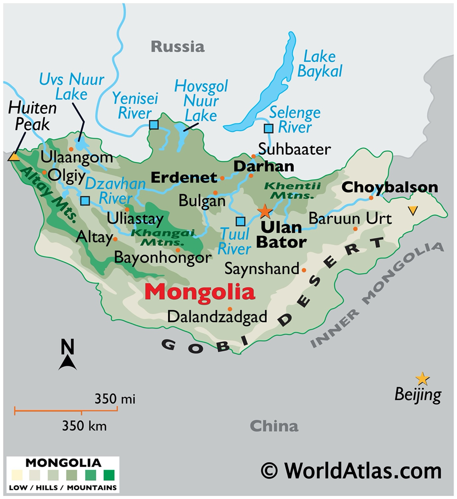
Mongolia
Why in news?
- Mongolia recently witnessed a rare red aurora, captivating residents with its ethereal beauty. Unlike typical green auroras, the red glow results from high-altitude oxygen atoms reacting to solar particles during heightened geomagnetic activity.
About Mongolia:
- Geography and Climate:
- Mongolia, a landlocked country in East Asia, is known for its vast steppes, mountains, and unique climate.
- Mongolia is located between Russia to the north and China to the south.
- The country spans an area of 1.56 million square kilometres, making it the 18th largest country in the world.
- The landscape is predominantly composed of broad steppes, deserts, and mountain ranges. The Altai Mountains in the west are the highest, with peaks reaching over 4,000 meters.
- The Gobi Desert, one of the largest deserts in Asia, lies in the south and is known for its extreme temperatures and diverse ecosystems.
- Mongolia experiences a continental climate, characterised by extreme temperature fluctuations.
- Summers are short and warm, with temperatures reaching as high as 40°C in some areas, while winters are long and harsh, with temperatures often dipping below -40°C.
- The country also faces strong winds and very little rainfall, making it prone to droughts and dust storms.
- Due to its location in the interior of the continent, Mongolia’s climate is influenced by both the Siberian cold and the dry, hot air from the Gobi Desert.
- Wildlife:
- Mongolia boasts a rich and diverse wildlife population, particularly in its remote, protected areas. Iconic species include the Mongolian gazelle, wild Bactrian camels, snow leopards, and marmots.
- The Saiga antelope, once widespread across Central Asia, has made a comeback in parts of Mongolia’s steppes.
- The Przewalski’s horse, the last wild horse species, was reintroduced to Mongolia after being nearly driven to extinction.
Recent Red Aurora Activity in Mongolia
- Mongolia recently witnessed a rare red aurora, a phenomenon that captivated both scientists and sky enthusiasts. Unlike the common green auroras, the red auroras are less frequent and are caused by unique atmospheric conditions.
Key Facts About Red Auroras:
- Red auroras occur when high-energy solar particles interact with oxygen molecules at altitudes above 200 kilometres. The interaction excites oxygen atoms, producing a vivid red hue.
- The recent event was linked to an intense coronal mass ejection (CME) from the Sun. The CME caused a geomagnetic storm, increasing the intensity of auroras globally.
- Red auroras appear at higher altitudes than green auroras. The red light is emitted at a wavelength of 630 nanometres, differing from the green's 557.7 nanometres.
Why It Was Unique?
- Red auroras are typically weaker and harder to see compared to green auroras. The intensity of this particular event was notable, making it visible even at lower latitudes.
- The aurora's vivid colours stretched across the sky, creating a stunning display against Mongolia's clear, dark night skies.
You Can Read Also: PLACES IN NEWS 2nd JANUARY 2025
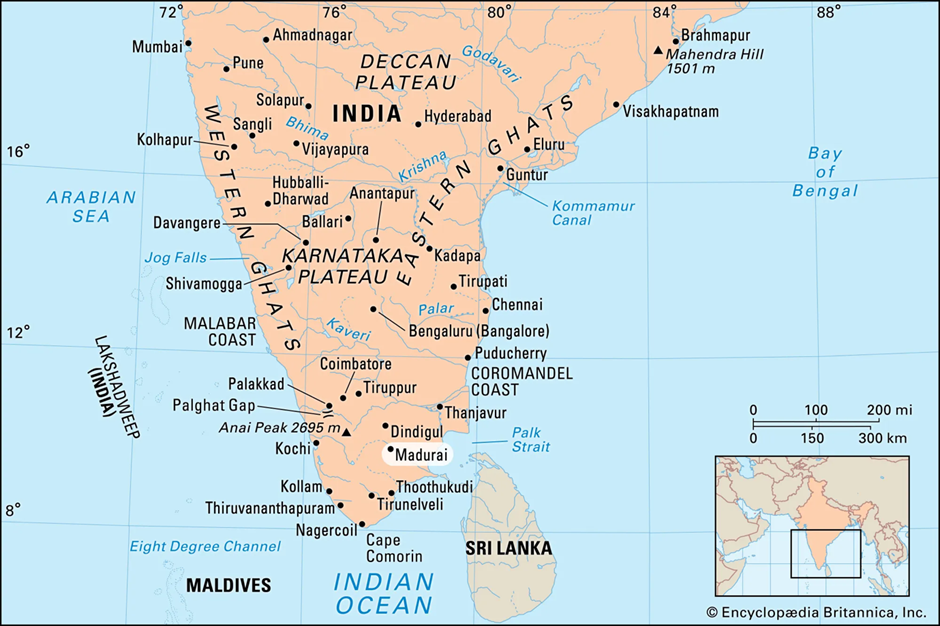
Madurai
Why in news?
- In Madurai, Tamil Nadu, mining for tungsten has sparked widespread controversy and opposition. The project, approved by the Centre, is proposed in a heritage site, raising concerns about its impact on the region's cultural and environmental legacy.
About Madurai:
- Geography:
- Madurai, located in Tamil Nadu, is one of India’s oldest cities, steeped in history, culture, and natural beauty.
- It lies on the fertile plains of southern India, with the Vaigai River flowing through it, serving as a lifeline for agriculture and drinking water.
- The river has shaped the city’s settlement patterns and sustains the local ecosystem. Surrounded by rolling hills, Madurai enjoys a tropical climate, making it a hub for agricultural activities and tourism.
- History and culture:
- Madurai's origins trace back over 2,500 years. It served as the capital of the Pandya dynasty, earning fame as a centre of Tamil culture, language, and governance.
- The city played a pivotal role in the Sangam era, hosting Tamil poets and scholars who enriched its cultural fabric.
- Successive rulers, including the Cholas, Vijayanagara emperors, and later the Nayaks, left an indelible mark on its architecture and traditions.
- Meenakshi Amman Temple, a masterpiece of Dravidian architecture, stands as a testament to Madurai’s historical and spiritual importance.
- Culturally, Madurai is known as the "Temple City," attracting pilgrims and tourists alike. It is a significant centre for Tamil festivals like Chithirai Thiruvizha and Pongal, which showcase the city’s vibrant traditions.
- Art forms like Bharatanatyam and folk music thrive here, while the bustling bazaars reflect its economic and cultural dynamism. The city's influence extends beyond religion and art, as it has also been a centre for Tamil literature and learning.
- Recent Controversy:
- Madurai is grappling with the challenge of proposed tungsten mining in a heritage-rich area. Tungsten, vital for various industries, has attracted the government’s interest due to the region’s resource potential. While the project offers economic benefits, it poses serious risks to Madurai’s ecological and cultural landscape.
- Mining could disrupt the natural ecosystem by altering terrain, depleting water resources, and harming biodiversity. The Vaigai River, critical for agriculture and drinking water, risks contamination and reduced flow. Residents fear irreversible damage to the region’s fragile environmental balance.
- The site also holds cultural and historical significance. Mining threatens to destroy ancient structures and artifacts, severing links to Madurai’s heritage. Local communities have voiced concerns over losing cultural landmarks to industrial activities.
- Protests reflect the tension between development and conservation. Authorities must balance economic progress with protecting Madurai’s ecology and legacy, ensuring sustainable practices that honour its historical and cultural significance.
Hotan prefecture
Why in news?
- India has lodged a strong protest with China over the creation of two new counties, He’an and Hekang, in the Hotan prefecture of the Xinjiang region, which incorporates parts of Indian territory in Ladakh.
About Hotan Prefecture:
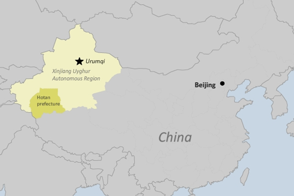
- Geography:
- Hotan Prefecture, located in the southern part of the Xinjiang Uyghur Autonomous Region of China, is a vast area of geographical, cultural, and political significance. Geographically, it lies in the Tarim Basin and is bordered by the Taklamakan Desert to the north and the Kunlun Mountains to the south.
- The region’s harsh desert environment contrasts with fertile oases sustained by glacial meltwater from the mountains. Hotan is known for its jade production, which has been a central aspect of its economy for centuries.
- Demography:
- The population of Hotan Prefecture primarily consists of Uyghurs, a Turkic ethnic group, along with smaller communities of Han Chinese and other ethnic minorities.
- The region is a cultural hub for Uyghur traditions, featuring Islamic architecture, vibrant bazaars, and a rich history of Silk Road trade. However, it has also been the focus of intense scrutiny due to alleged human rights violations and cultural suppression by Chinese authorities.
- Recent regional dispute:
- India recently protested China's creation of He’an County and Hekang County within Hotan Prefecture, which incorporates parts of Aksai Chin, a territory claimed by India but controlled by China.
- The Indian government has categorically rejected this administrative manoeuvre, reiterating its sovereignty over the area. This protest reflects India's long-standing stance against China's occupation of Aksai Chin, which occurred during the 1962 Sino-Indian War. The move also highlights China's broader strategy to strengthen its administrative grip over disputed regions, further complicating the bilateral relationship.
- India has also raised concerns about a Chinese mega hydropower project on the Yarlung Tsangpo (Brahmaputra River), which could impact water flows into India’s north-eastern states. These developments underscore the ongoing tensions over territorial disputes and resource management between the two nations.
Regions of Territorial Disputes Between India and China:
|
Region |
Details |
|
Aksai Chin (Eastern Ladakh) |
Controlled by China but claimed by India. Captured during the 1962 Sino-Indian War. |
|
Arunachal Pradesh |
Claimed by China as part of South Tibet; contested by India as integral to its territory. |
|
Doklam Plateau (Sikkim) |
Tri-junction area involving Bhutan, claimed by China, leading to the 2017 Doklam standoff. |
|
Barahoti Plains (Uttarakhand) |
Small area with recurring Chinese intrusions; not formally demarcated as per the border agreements. |
|
Demchok (Eastern Ladakh) |
Frequent Chinese incursions in the area claimed by India. |
|
Depsang Plains (Eastern Ladakh) |
Strategically important plateau, currently controlled by China but claimed by India. |
|
UPSC CSE PYQs Q. With reference to the Himalayan rivers joining the Ganga downstream of Prayagraj from West to East, which one of the following sequences is correct? (2024) (a) Ghaghara – Gomati – Gandak – Kosi (b) Gomati – Ghaghara – Gandak – Kosi (c) Ghaghara – Gomati – Kosi – Gandak (d) Gomati – Ghaghara – Kosi – Gandak Answer: Option B |
|
Also Read |
|
What is Mosura Fentoni?
India-Germany Strategic Partnership: Silver Jubilee
How India’s Coastline Lengthened Without Gaining New Land
Karol Bagh Metro Pillar No. 112, Above Domino's, 22B, First Floor, New Delhi - 110060
Very Important Instruction For Any Issue, Student Must Produce His/Her Fee Receipt. Without Fee Receipt, It Will Not Be Possible To Track Your Details. If You Have Been Given Any Special Consideration, You Must Keep That In Writing And Produce In Case Of Conflict.
Copyright © 2024-2026 ENSURE IAS. All rights reserved.