- Courses
- GS Full Course 1 Year
- GS Full Course 2 Year
- GS Full Course 3 Year
- GS Full Course Till Selection
- CSAT
- 5 LAYERED ARJUNA Mentorship
- Public Administration Optional
- Online Program
- GS Recorded Course
- NCERT Batch
- Polity Module Course
- Geography Module Course
- Economy Module Course
- AMAC Module Course
- Modern India, Post Independence & World History Module Course
- Environment Module Course
- Governance Module Course
- Science & Tech. Module Course
- International Relations and Internal Security Module Course
- Disaster Management Module Course
- Ethics Module Course
- Essay Module Course
- Current Affairs Module Course
- ABOUT US
- OUR TOPPERS
- TEST SERIES
- FREE STUDY MATERIAL
- VIDEOS
- CONTACT US
Tsunami Zones in India
Tsunami Zones in India
14-04-2025
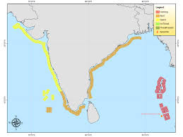
Insights from the Indian National Centre for Ocean Information Services (INCOIS)
India's extensive coastline, stretching across multiple states and Union Territories, is vulnerable to tsunamis due to its proximity to two significant tectonic subduction zones.
These zones are geologically active and capable of generating powerful undersea earthquakes, which in turn can trigger tsunamis affecting the Indian coastline.
1. Andaman-Nicobar–Sumatra Island Arc
- This zone forms a 5,000-kilometre-long tectonic boundary extending from Myanmar in the north to the Indonesian archipelago in the south.
- It is one of the most prominent subduction zones in the region, where the Indian Plate is being pushed beneath the Eurasian Plate.
- The tectonic activity in this region has historically triggered devastating tsunamis, including the 2004 Indian Ocean tsunami, making it a critical area for seismic monitoring.
2. Makran Subduction Zone
- Located in the northwestern Indian Ocean, this zone lies off the coasts of southeastern Iran and southwestern Pakistan.
- Here, the Arabian Sea Plate is subducting beneath the Eurasian Plate, forming another high-risk seismic area.
- Though less active than the Andaman-Nicobar arc, the Makran Subduction Zone remains a potential source of tsunamis, particularly for India's western coastal regions.
|
Also Read |
|
| FREE NIOS Books | |

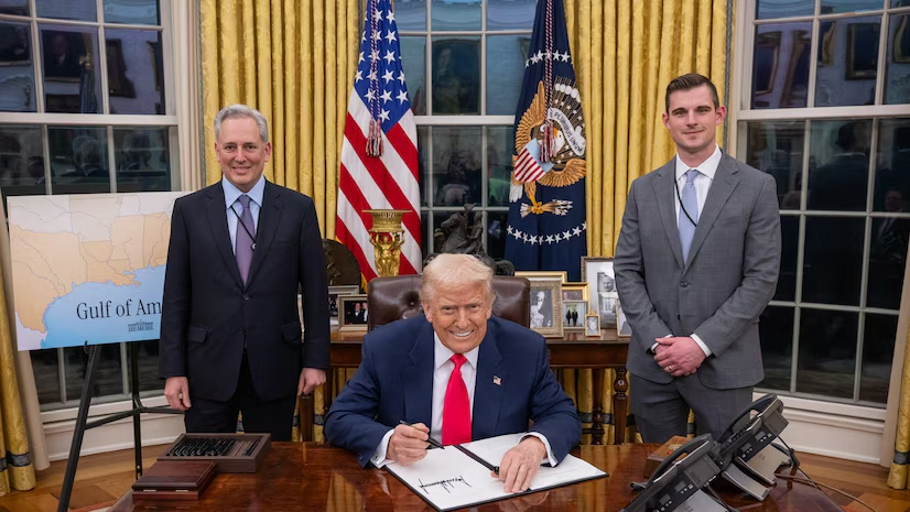
Donald Trump’s Strategic Bitcoin Reserve Executive Order
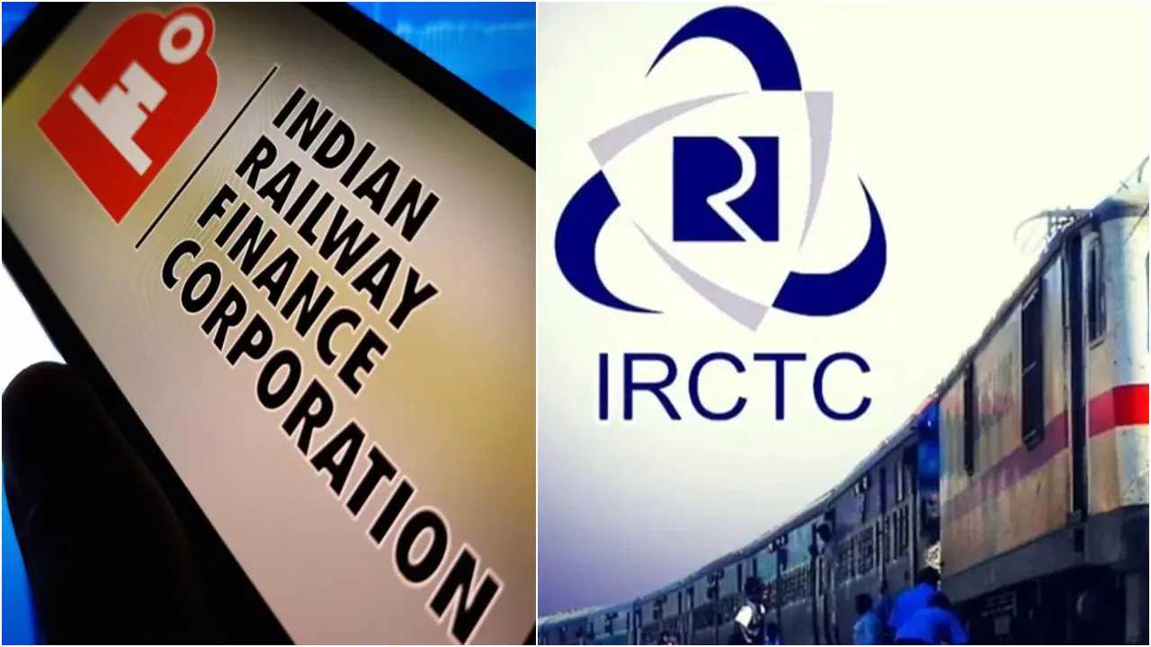
Navratna Status For IRCTC And IRFC

Kirsty Coventry Becomes First Female IOC President
Karol Bagh Metro Pillar No. 112, Above Domino's, 22B, First Floor, New Delhi - 110060
Copyright © 2024-2026 ENSURE IAS. All rights reserved.