- Courses
- GS Full Course 1 Year
- GS Full Course 2 Year
- GS Full Course 3 Year
- GS Full Course Till Selection
- CSAT
- 5 LAYERED ARJUNA Mentorship
- Public Administration Optional
- Online Program
- GS Recorded Course
- NCERT (Recorded 500+ Hours)
- Polity Recorded Course
- Geography Recorded Course
- Economy Recorded Course
- AMAC Recorded Course
- Modern India, Post Independence & World History
- Environment Recoded Course
- Governance Recoded Course
- Science & Tech. Recoded Course
- International Relations and Internal Security Recorded Course
- Disaster Management Module Course
- Ethics Recoded Course
- Essay Recoded Course
- Current Affairs Recoded Course
- ABOUT US
- OUR TOPPERS
- TEST SERIES
- FREE STUDY MATERIAL
- VIDEOS
- CONTACT US
PLACES IN NEWS 10 NOVEMBER 2024
PLACES IN NEWS 10 NOVEMBER 2024
10-11-2024
6th Session of the Joint Permanent Commission in Lusaka: Zambia
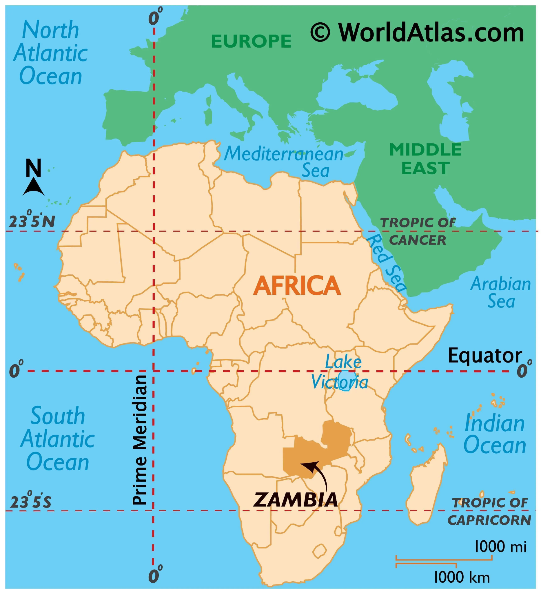
In November 2024, India-Zambia held the 6th Session of the Joint Permanent Commission in Lusaka.
- Location: Landlocked country in south-central Africa, situated on a high plateau.
- Name Origin: Named after the Zambezi River, which drains most of the country (except a small northern portion).
- Borders:
- North: Democratic Republic of the Congo
- South: Zimbabwe, Botswana
- North-East: Tanzania
- West: Malawi, Angola
- South-East: Mozambique
- South-West: Namibia
- Economy:
- Main Sector: Mining, especially copper extraction.
- Zambia's economy is highly dependent on copper mining.
- Language: Majority of Zambians speak Bantu languages from the Niger-Congo language family.
- Natural Features:
- Victoria Falls: Located on the Zambezi River, one of the world's largest waterfalls.
- Lake Kariba: Largest artificial reservoir by volume, created by the Kariba Dam on the Zambezi River.
- Capital: Lusaka
Exercise AUSTRAHIND
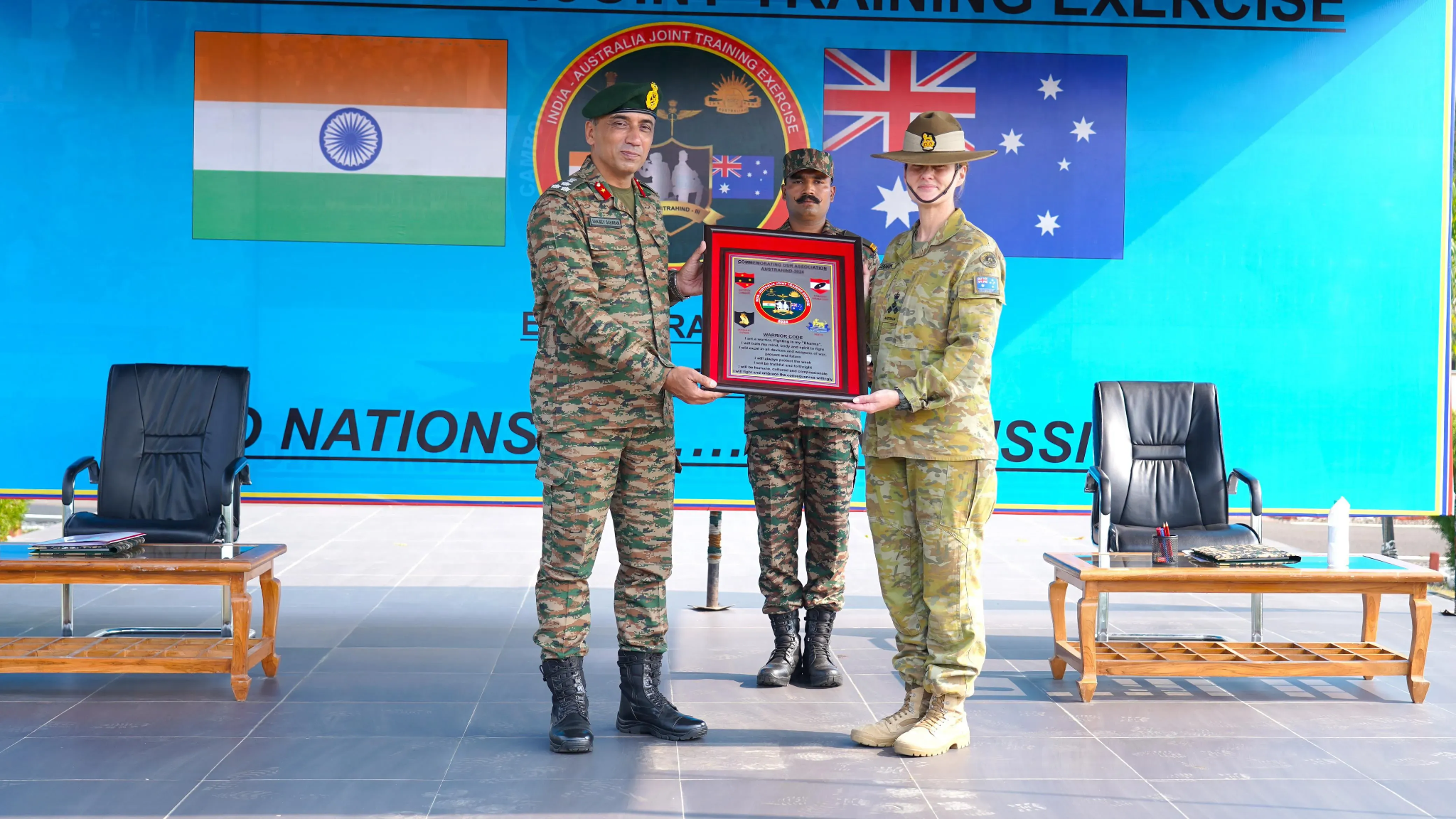
- The 3rd edition of Exercise AUSTRAHIND commenced on 8th November 2024 at the Foreign Training Node, Pune (Maharashtra).
- The exercise will run until 21st November 2024.
- Participants:
- India and Australia conduct this joint military exercise.
- The Indian contingent includes 140 personnel, primarily from a battalion of the DOGRA Regiment, with 14 personnel from the Indian Air Force.
- Frequency & Location:
- The exercise is held annually, alternating between India and Australia.
- The last edition took place in Australia in December 2023.
- Aim:
- To promote military cooperation between India and Australia.
- Focus on enhancing interoperability in conducting joint sub-conventional operations in semi-urban environments and semi-desert terrain under Chapter VII of the UN mandate.
- Exercise Phases:
- Combat Conditioning & Tactical Training Phase
- Validation Phase
- Drills & Aspects:
- Response to terrorist actions (capturing defined territory).
- Establishment of Joint Operations Centre.
- Joint counter-terrorism operations: Raid and Search & Destroy Missions.
- Securing a helipad, employment of drones, and counter-drone measures.
- Special Heli Borne Operations.
- Significance:
- Enhances tactical cooperation and sharing of best practices between the two nations in terms of tactics, techniques, and procedures for conducting tactical operations.
Food Insecurity in the Horn of Africa
- At least 65 million people are food insecure in the Horn of Africa.
- In November 2024, It was revealed by a joint report released by the UN and the Intergovernmental Authority on Development, IGAD, an East African bloc.
- This marks a slight decline from 66 million in August, largely due to improved rainfall over the past two seasons, especially in the IGAD region (Intergovernmental Authority on Development).
- Affected Region:
- 36 million of the 65 million affected people live in IGAD member states, which include:
- Djibouti, Eritrea, Ethiopia, Kenya, Somalia, South Sudan, Sudan, and Uganda.
- 36 million of the 65 million affected people live in IGAD member states, which include:
- Primary Causes:
- Extreme weather and climate change are the main drivers of the food insecurity crisis, with these events becoming more severe and frequent.
- Conflict has contributed to widespread destruction of infrastructure, leading to loss of food sources and income, worsening the food security situation.
- Key Findings:
- The region's food insecurity is exacerbated by climate change and conflict, creating a challenging environment for recovery and relief efforts.
About Horn of Africa:
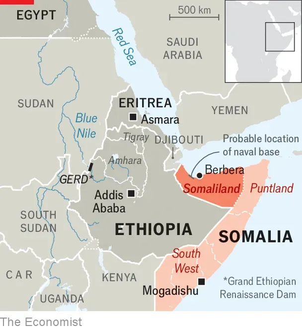
- Geography:
- The easternmost extension of African land, often referred to as the Horn of Africa.
- Comprises four countries: Djibouti, Eritrea, Ethiopia, and Somalia.
- The region also includes the Somali Peninsula.
- Diverse Landscape:
- Features areas such as the Ethiopian Plateau highlands, the Ogaden desert, and the Eritrean and Somali coasts.
- Home to various ethnic groups, including the Amhara, Tigray, Oromo, and Somali peoples.
- Coastal Geography:
- Coasts washed by the Red Sea, Gulf of Aden, and the Indian Ocean.
- The region has had longstanding contact with the Arabian Peninsula and Southwestern Asia.
- Strategic Location:
- Separated from the Arabian Peninsula by the Bab el-Mandeb Strait, a critical waterway linking the Red Sea to the Gulf of Aden.
- Challenges:
- The region faces severe food insecurity, worsened by the climate crisis and ongoing conflict.
- Key challenges include malnutrition, cholera, and other health crises.

Must Check: Best IAS Coaching In Delhi
UPSC Prelims Result 2024 Out: Expected Cut Off & Other Details, UPSC Prelims 2024 Answer with Explanation, Daily Prelims Quiz, Daily Current Affairs, MONTHLY CURRENT AFFAIRS TOTAL (CAT) MAGAZINE, Best IAS Coaching Institute in Karol Bagh, Best IAS Coaching Institute in Delhi, Daily Mains Question Answer Practice, ENSURE IAS UPSC Toppers, UPSC Toppers Marksheet, Previous Year Interview Questions, UPSC Syllabus
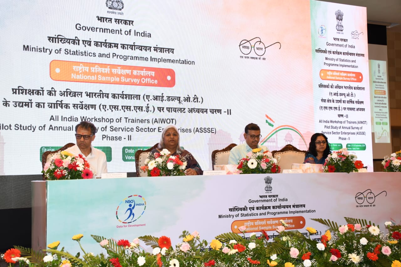
Pilot Study on Annual Survey of Services Sector Enterprises (ASSSE)

PLACES IN NEWS 3rd MAY 2025
Stockholm Convention on Persistent Organic Pollutants (POPs)
Karol Bagh Metro Pillar No. 112, Above Domino's, 22B, First Floor, New Delhi - 110060
Copyright © 2024-2026 ENSURE IAS. All rights reserved.