- Courses
- GS Full Course 1 Year
- GS Full Course 2 Year
- GS Full Course 3 Year
- GS Full Course Till Selection
- CSAT
- 5 LAYERED ARJUNA Mentorship
- Public Administration Optional
- Online Program
- GS Recorded Course
- NCERT (Recorded 500+ Hours)
- Polity Recorded Course
- Geography Recorded Course
- Economy Recorded Course
- AMAC Recorded Course
- Modern India, Post Independence & World History
- Environment Recoded Course
- Governance Recoded Course
- Science & Tech. Recoded Course
- International Relations and Internal Security Recorded Course
- Disaster Management Module Course
- Ethics Recoded Course
- Essay Recoded Course
- Current Affairs Recoded Course
- ABOUT US
- OUR TOPPERS
- TEST SERIES
- FREE STUDY MATERIAL
- VIDEOS
- CONTACT US
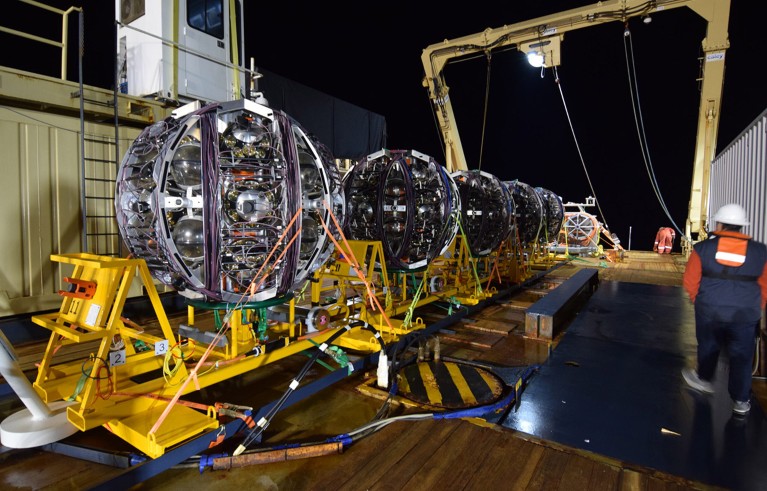
India’s First Private Satellite Constellation ‘Firefly’ Launched
India’s First Private Satellite Constellation ‘Firefly’ Launched

- India’s private space-tech company Pixxel has achieved a major milestone by launching India’s first private satellite constellation called Firefly.
- The constellation consists of six hyperspectral imaging satellites, which are the highest-resolution commercial hyperspectral satellites to date.
|
Key Players in Satellite Constellations
|
Successful Launch of the First Three Satellites
- The first three satellites of the Firefly constellation were successfully launched on SpaceX’s Transporter-12 mission from Vandenberg Space Force Base, California.
- This launch marks the beginning of Pixxel's journey to provide advanced Earth observation capabilities through its innovative satellite constellation.
About Firefly Satellite Constellation
- Firefly is Pixxel’s flagship satellite constellation, which is designed to offer cutting-edge Hyperspectral Imaging (HSI) capabilities.
- These satellites will provide detailed and accurate data for a wide range of applications, including agriculture, climate monitoring, and resource management.
Understanding Hyperspectral Imaging (HSI)
- Hyperspectral Imaging (HSI) is an advanced technology used to analyze a broader range of light spectra than traditional imaging systems.
- While conventional satellites only capture images in three primary colors (red, green, and blue), HSI satellites capture many more spectral bands across the electromagnetic spectrum, allowing them to "fingerprint" the Earth in much greater detail.
- This provides more detailed insights about the Earth’s surface.
|
Diverse Applications of HSI
|
Benefits of HSI:
- Traditional satellites can identify broad features like forests or water bodies, while HSI can go deeper, distinguishing between different types of trees and even determining the health of individual trees.
- This capability enables more precise monitoring and analysis, offering a deeper understanding of environmental, agricultural, and industrial phenomena.
What is a Satellite Constellation?
A satellite constellation refers to a network of identical satellites working together for a common purpose. These satellites are typically controlled together, and they communicate with ground stations, sometimes even interconnecting to enhance their overall function.
Key Features of Satellite Constellations:
- They work as a system to achieve a specific goal, such as providing global communications, Earth observation, or navigation services.
- Constellations are often designed to complement each other’s functions, ensuring more comprehensive and reliable service coverage.
Types of Satellite Orbits
Satellite constellations can be placed in different orbits, depending on their purpose. There are three primary types of orbits, each serving a distinct function:
- Geostationary Orbit (GEO):
- Altitude: 36,000 km
- Function: Satellites in GEO orbit synchronize with the Earth's rotation, making them ideal for communications, weather monitoring, and broadcasting services.
- Medium Earth Orbit (MEO):
- Altitude: Between 5,000 to 20,000 km
- Function: MEO satellites are commonly used for navigation purposes, such as GPS and other satellite-based positioning systems.
- Low Earth Orbit (LEO):
- Altitude: Between 500 to 1,200 km
- Function: LEO satellites support a variety of applications, including research, telecommunications, and Earth observation.
- This is the orbit in which Pixxel's Firefly satellites operate, enabling high-resolution imaging for applications like agriculture, climate monitoring, and environmental monitoring.


The Rise of AI Washing: Misleading Consumers and the Need for AI Literacy
The Most Energetic Neutrino Ever Detected
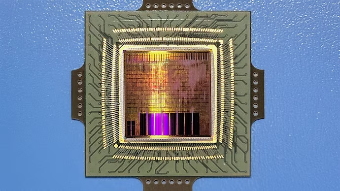
IIT Madras and ISRO Develop Indigenous Shakti-Based Semiconductor Chip
Karol Bagh Metro Pillar No. 112, Above Domino's, 22B, First Floor, New Delhi - 110060
Copyright © 2024-2026 ENSURE IAS. All rights reserved.