- Courses
- GS Full Course 1 Year
- GS Full Course 2 Year
- GS Full Course 3 Year
- GS Full Course Till Selection
- Answer Alpha: Mains 2025 Mentorship
- MEP (Mains Enrichment Programme) Data, Facts
- Essay Target – 150+ Marks
- Online Program
- GS Recorded Course
- Polity
- Geography
- Economy
- Ancient, Medieval and Art & Culture AMAC
- Modern India, Post Independence & World History
- Environment
- Governance
- Science & Technology
- International Relations and Internal Security
- Disaster Management
- Ethics
- NCERT Current Affairs
- Indian Society and Social Issue
- NCERT- Science and Technology
- NCERT - Geography
- NCERT - Ancient History
- NCERT- World History
- NCERT Modern History
- CSAT
- 5 LAYERED ARJUNA Mentorship
- Public Administration Optional
- ABOUT US
- OUR TOPPERS
- TEST SERIES
- FREE STUDY MATERIAL
- VIDEOS
- CONTACT US
PLACES IN NEWS 10th FEBRUARY 2025
PLACES IN NEWS 10th FEBRUARY 2025

Daya River
Why in news?
- Activists urge action to clean Odisha’s Daya River, polluted by industrial waste, sewage, and agricultural runoff, threatening ecosystems and livelihoods.
About Daya River:
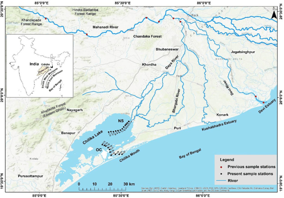
- Origin:
- The Daya River originates from the Kusabhadra River in Odisha and flows through Khurda and Puri districts before emptying into Chilika Lake.
- Covering a length of approximately 37 km, it receives water from tributaries like the Malaguni River, influencing local hydrology and ecosystems.
- Ecological and Economical Significance:
- It supports wetland biodiversity, providing a habitat for fish and migratory birds near Chilika Lake, crucial for ecological balance.
- Additionally, the river sustains agriculture and fishing communities, playing a key role in the local economy by facilitating irrigation and fishery-based livelihoods.
- Reason behind rise in Pollution:
- Industrial and Sewage Discharge: Unregulated industrial effluents and urban sewage enter the river, contaminating water quality and harming aquatic life.
- Agricultural Runoff: Excessive use of fertilizers and pesticides in farmlands along its banks leads to chemical pollution, affecting the river's ecosystem.
- Encroachment and Waste Dumping: Unchecked encroachment, sand mining, and solid waste disposal contribute to siltation and degradation, reducing the river’s flow and oxygen levels.
- Other Key Facts:
- The Kalinga War (261 BCE) was fought near the Daya River, where Emperor Ashoka witnessed the bloodshed, prompting his transformation towards Buddhism and non-violence.
Cascade Range
Why in news?
- Scientists have discovered massive magma reservoirs beneath dormant Cascade Range volcanoes, raising concerns about potential future eruptions and improving understanding of volcanic activity, magma storage, and geological processes in the region.
About Cascade Range:
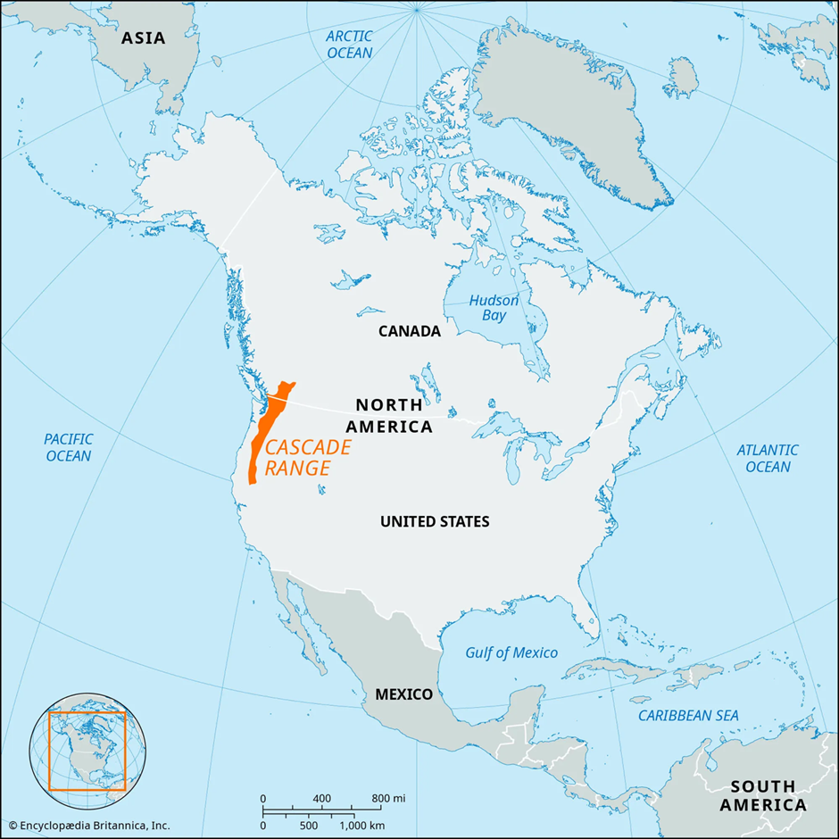
- Location and Formation:
- The Cascade Range spans the Pacific Northwest, extending from northern California through Oregon and Washington into southwestern Canada.
- It was formed due to the subduction of the Juan de Fuca Plate beneath the North American Plate. This process continues to drive volcanic and tectonic activity in the region.
- The range is a part of the Pacific Ring of Fire, a zone of frequent earthquakes and volcanic eruptions encircling the Pacific Ocean.
- Topography:
- The Cascades, characterised by snow-capped peaks, massive glaciers, steep scree slopes, and dense forests, exhibit a striking mix of rugged terrain and volcanic landforms.
- The range consists of 4375 named mountains, with Mount Rainier (4,392 m) being the tallest and most prominent peak.
- It includes both non-volcanic mountains, such as the North Cascades, known for their jagged spires, and volcanic peaks, referred to as the High Cascades, which dominate the landscape.
- Previous Volcanic Activity:
- The Cascades are among the most volcanically active regions in the United States. Every historical eruption in the contiguous U.S. has occurred from Cascade volcanoes, highlighting their geophysical significance.
- Notable past eruptions include Mount St. Helens (1980), which resulted in massive destruction, and earlier eruptions from Mount Rainier, Mount Baker, and Mount Hood.
- These volcanoes remain closely monitored due to their potential for future activity.
- Weather:
- The Cascade Range significantly influences regional weather patterns. It acts as a climatic barrier, causing heavy rainfall on the western slopes while creating rain shadows in the interior regions.
- The range is also affected by Chinook winds, warm, dry winds that descend on the leeward side, rapidly increasing temperatures and melting snow.
- These winds play a crucial role in winter climate moderation and can lead to sudden thawing, impacting local ecosystems and hydrology.
Democratic Republic of Congo
Why in news?
- Rwanda-backed M23 rebels seized Goma, a key city in the Democratic Republic of Congo's mineral-rich and conflict-ridden east, escalating instability in a region plagued by violence and resource-driven tensions.
About Democratic Republic of Congo
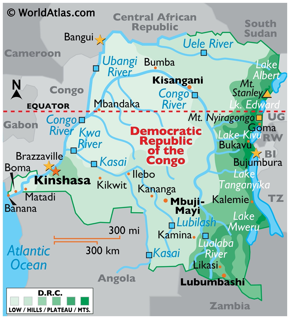
- Location and Geography:
- The Democratic Republic of Congo (DRC) is located in Central Africa, bordered by nine countries, including Rwanda, Uganda, and Angola.
- It is the second-largest country in Africa and features vast rainforests, savannas, and river systems, with the Congo River being a crucial waterway for transportation and hydroelectric potential.
- Potential Mineral Resources:
- DRC is one of the world’s richest countries in terms of natural resources, holding vast reserves of cobalt, copper, gold, diamonds, and coltan—essential for modern technology.
- It supplies over 70% of the world’s cobalt, a critical element for batteries and electric vehicles.
- However, illegal mining, corruption, and armed group control over mines have hindered equitable resource utilisation, fuelling regional instability.
- Civilian Crisis:
- The conflict in eastern DRC stems from ethnic tensions, spill over from the 1994 Rwandan Genocide, and the presence of numerous armed groups, including the Rwanda-backed M23 rebels.
- These conflicts have led to mass displacement, humanitarian crises, and human rights violations, with millions of civilians forced to flee their homes.
- Widespread violence, looting, and attacks on civilians exacerbate poverty and insecurity, limiting access to basic services.
- Regions in the News:
- The provinces of North Kivu, South Kivu, and Ituri remain conflict hotspots due to rebel activities, mineral wealth, and ethnic clashes.
- The recent capture of Goma, the capital of North Kivu, by M23 rebels has intensified instability, drawing international concern over regional security and humanitarian conditions.
Tibetan Plateau
Why in news?
- Scientists highlight the Tibetan Plateau as evidence of ongoing human evolution, where Tibetans developed genetic adaptations for high-altitude survival, including efficient oxygen utilization, demonstrating natural selection in modern populations.
About Tibetan Plateau:
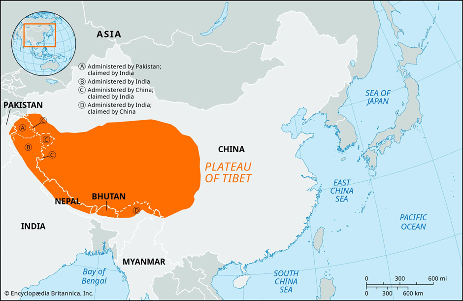
- Location:
- The Tibetan Plateau, often called the "Roof of the World," is the highest and largest plateau on Earth, covering an area of approximately 2.5 million square kilometres.
- It spans Tibet, Qinghai, parts of India (Ladakh, Arunachal Pradesh), and Nepal. This plateau is the source of major Indian rivers, including the Indus, Brahmaputra, and Sutlej, which originate from its glaciers and sustain millions of people across South Asia.
- Formation:
- The Tibetan Plateau was formed due to the collision of the Indian Plate with the Eurasian Plate around 50 million years ago, a process that continues to uplift the region.
- This ongoing tectonic activity has not only shaped the Himalayas but also contributed to earthquakes and geological instability in the region.
- Influence on Indian Climate:
- The Tibetan Plateau significantly impacts South Asian weather patterns, especially through its effect on the jet streams and the Indian monsoon.
- During summer, the intense heating of the plateau creates a low-pressure system, drawing in moisture-laden winds from the Indian Ocean, strengthening the monsoon rains.
- In winter, the plateau cools rapidly, reinforcing westerly jet streams, which bring Western Disturbances responsible for winter rainfall and snowfall in North India and the Western Himalayas. These climatic influences make the Tibetan Plateau a key driver of India's seasonal weather variations.
- Role in Human Evolution:
- The Tibetan Plateau provides strong evidence of ongoing human evolution through genetic adaptations in Tibetan populations.
- Living at altitudes exceeding 4,000 meters, Tibetans have developed unique genetic traits that allow them to thrive in low-oxygen environments.
- A key adaptation is a mutation in the EPAS1 gene, inherited from the ancient Denisovan hominins, which enhances oxygen utilisation and prevents altitude sickness.
- This natural selection in modern human populations demonstrates that human evolution is an ongoing process, shaped by environmental challenges.
|
UPSC CSE PYQs
Q1. About three-fourths of the world's cobalt, a metal required for the manufacture of batteries for electric motor vehicles, is produced by (2023)
Answer: Option C Q2. Consider the following pairs:
How many of the above pairs are correctly matched? (2023)
Answer: Option D
Q3. The word ‘Denisovan’ is sometimes mentioned in media in reference to: (2019)
Answer: Option B
|
|
Also Read |
|
| FREE NIOS Books | |

ECI to Verify Voter List in Bihar

India Opens Doors to Foreign Universities

Coordination Between Fiscal and Monetary Policy
Karol Bagh Metro Pillar No. 112, Above Domino's, 22B, First Floor, New Delhi - 110060
Very Important Instruction For Any Issue, Student Must Produce His/Her Fee Receipt. Without Fee Receipt, It Will Not Be Possible To Track Your Details. If You Have Been Given Any Special Consideration, You Must Keep That In Writing And Produce In Case Of Conflict.
Copyright © 2024-2026 ENSURE IAS. All rights reserved.